E002 - Interview With Topi Tjukanov on Open Source vs Commercial GIS
Posted on Tuesday, Nov 26, 2019
Show Notes
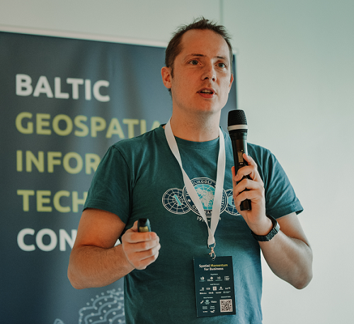
After our battling discussion on the first episode on the pros and cons of open source and commercial GIS softwares, we got lucky to have an honorable guest Topi Tjukanov, who shared his expertise and experience working with open source softwares and data. Topi is a geospatial data enthusiast who works with visualization and latest tricks in modern GIS. Topi also works with GISPO, a company which provides open source solutions to different problems. Host Alex and Tahmin talks with Topi on the pros and cons of Open source and enterprise softwares and what the future looks like for GIS data and science. Please let us know how we can improve and design our show to your liking. Comment, like and subscribe.
Topi’s website: https://tjukanov.org/aboutme
We also want to share around 5 or more recent interesting articles on GIS with every episode so that you and we have the idea on what kind of research is going on in the field of GIS:
-
Transactions in GIS, Wiley | Enhancing spatial and textual analysis with EUPEG: An extensible and unified platform for evaluating geoparsers https://onlinelibrary.wiley.com/doi/abs/10.1111/tgis.12579?af=R (subscription needed)
-
IJGIS - International Journal of Geographical Information Science, Taylor & Francis | Real-time GIS for smart cities https://www.tandfonline.com/doi/full/10.1080/13658816.2019.1673397?af=R (open access)
-
Journal of Spatial Science, Taylor & Francis | Multi-GNSS precise point positioning with next-generation smartphone measurements https://www.tandfonline.com/doi/full/10.1080/14498596.2019.1664944?af=R (subscription needed)
-
IJGI - ISPRS International Journal of Geo-Information, MDPI | Parallel Cellular Automata Markov Model for Land Use Change Prediction over MapReduce Framework https://www.mdpi.com/2220-9964/8/10/454 (open access)
-
IJGI - ISPRS International Journal of Geo-Information, MDPI | pyjeo: A Python Package for the Analysis of Geospatial Data https://www.mdpi.com/2220-9964/8/10/461 (open access)
-
IJGIS - International Journal of Geographical Information Science, Taylor & Francis | CostMAP: an open-source software package for developing cost surfaces using a multi-scale search kernel https://www.tandfonline.com/doi/full/10.1080/13658816.2019.1675885?af=R (subscription needed)
-
IJGI - ISPRS International Journal of Geo-Information, MDPI | Machine Learning Methods for Classification of the Green Infrastructure in City Areas https://www.mdpi.com/2220-9964/8/10/463 (open access)
-
IJGI - ISPRS International Journal of Geo-Information, MDPI | Geobia Achievements and Spatial Opportunities in the Era of Big Earth Observation Data https://www.mdpi.com/2220-9964/8/11/474 (open access)
-
IJDE - International Journal of Digital Earth, Taylor & Francis | The 11th International Symposium on Digital Earth, Florence DECLARATION by the International Society for Digital Earth https://www.tandfonline.com/doi/full/10.1080/17538947.2019.1681645?af=R (open access)
-
ESSD - Earth System Science Data, Copernicus | EstSoil-EH v1.0: An eco-hydrological modelling parameters dataset derived from the Soil Map of Estonia https://doi.org/10.5194/essd-2019-192 (open access)
Guests

Topi Tjukanov
I’m a geographer (M.Sc.) with a business degree (BBA) from Helsinki, Finland. I work at Gispo with all things geospatial. I’m enthusiastic about geospatial data, visualizing it and learning the latest tricks in modern GIS.
Hosts

Alex Kmoch
Alex is a Distributed Spatial Systems Researcher with many years of international experience in geospatial data management and web- and cloud-based geoprocessing with a particular focus on land use, soils, hydrology, and water quality. His interests include OGC standards and web-services for location-based data sharing, modelling workflows, machine learning, and interactive geo-visualisation. Alex has been involved with SDIs and the OGC for a long time and was recently elected board member of the Estonian Geoinformatics Society (EstGIS) and European Co-Chair for the OGC University Domain Working Group. He is based at the Chair of Geoinformatics and Cartography at Department of Geography of the University of Tartu.

Tahmin Sitab
Tahmin Sitab is a masters student at the Geoinformatics for Urbanised society programme at University of Tartu. He did his bachelors in anthropology from Bangladesh. He is interested in the intersection of sociology and geography and almost every other topic. He firmly believes that you can love both a cat and a dog.