E003 - The Chair of Geoinformatics and Cartography of the Department of Geography at the University of Tartu
Posted on Wednesday, Dec 18, 2019
Show Notes
We are introducing the Chair of Geoinformatics and Cartography. We present an overview of the Chair and the activities and we managed to get three representatives, which we interview during the episode: Professor Tõnu Oja, who is the Head of the Chair of Geoinformatics and Cartography, senior researcher Dr Evelyn Uuemaa, who is leading the Landscape Geoinformatics Lab, and also became recently head of the Department of Geography, and the PhD student Bruno Montibeller. We apologise for the sound quality during some of the interviews, we promise to improve that in the next episode :-) Please let us know any suggestions or advice that can help us grow. Like always comment, like and subscribe.
https://www.geograafia.ut.ee/en/about-us/chair-geoinformatics-and-cartography
https://www.geograafia.ut.ee/en/studies/geoinformatics-urbanised-society-msc
We also want to share around 5 or more recent interesting articles on GIS with every episode so that you and we have the idea on what kind of research is going on in the field of GIS:
-
CaGIS - Cartography and Geographic Information Science, Taylor & Francis | Data scale as cartography: a semi-automatic approach for thematic web map creation https://www.tandfonline.com/doi/full/10.1080/15230406.2019.1677176?af=R (subscription needed)
-
Scientific Data, nature.com | Population centroids of the world administrative units from nighttime lights 1992-2013 https://www.nature.com/articles/s41597-019-0250-z (open access)
-
Regional Environmental Change, Springer | Operationalising ecosystem services in Europe http://link.springer.com/10.1007/s10113-019-01560-1 (open access)
-
Environmental Modelling & Software, Elsevier | From ad-hoc modelling to strategic infrastructure: a manifesto for model management https://www.sciencedirect.com/science/article/pii/S1364815219308461?dgcid=rss_sd_all (open access)
-
Transactions in GIS, Wiley | Extending Processing Toolbox for assessing the logical consistency of OpenStreetMap data https://onlinelibrary.wiley.com/doi/abs/10.1111/tgis.12587?af=R (subscription needed)
-
Environmental Modelling & Software, Elsevier | Percentile-Range Indexed Mapping and Evaluation (PRIME): A new tool for long-term data discovery and application https://www.sciencedirect.com/science/article/pii/S1364815219304517?dgcid=rss_sd_all (subscription needed)
-
Science of The Total Environment, Elsevier | Ecosystem services in a changing environment https://www.sciencedirect.com/science/article/pii/S0048969719350004?dgcid=rss_sd_all (subscription needed)
-
IJGI - ISPRS International Journal of Geo-Information, MDPI | Measuring SDG 15 at the County Scale: Localization and Practice of SDGs Indicators Based on Geospatial Information https://www.mdpi.com/2220-9964/8/11/515 (open access)
-
Water Resources Research, Wiley | Self‐organizing maps for evaluation of biogeochemical processes and temporal variations in water quality of subtropical reservoirs https://agupubs.onlinelibrary.wiley.com/doi/abs/10.1029/2019WR025991?af=R (subscription needed)
-
GIScience & Remote Sensing, Taylor & Francis | Agricultural cropland extent and areas of South Asia derived using Landsat satellite 30-m time-series big-data using random forest machine learning algorithms on the Google Earth Engine cloud https://www.tandfonline.com/doi/full/10.1080/15481603.2019.1690780?af=R (open access)
-
JAG: International Journal of Applied Earth Observation and Geoinformation, Elsevier | A new supervised classifier exploiting spectral-spatial information in the Bayesian framework https://www.sciencedirect.com/science/article/pii/S0303243418310638?dgcid=rss_sd_all (open access)
Guests
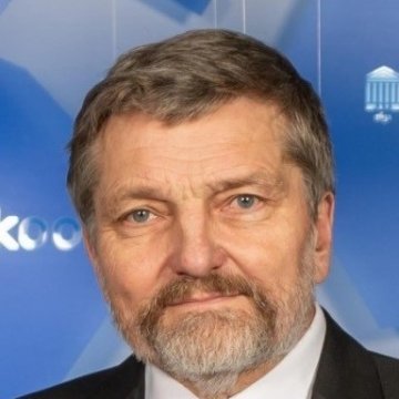

Evelyn Uuemaa
Evelyn is a geographer by heart and senior researcher in Geoinformatics, GIS and landscape ecology. She holds a PhD in landscape ecology and environmental protection, and is developing our Landscape Geoinformatics working group as a necessity to improve and strengthen environmental geoinformatics capabilities here at the department and for Estonia in general through leading national and international research projects. Her research interests evolve around the interactions of land use/land cover and water quality. She is a geospatial and open data enthusiast, foodie and coffee junkie.
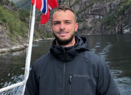
Bruno Montibeller
Bruno is a PhD student in the Department of Geography. His research interests are land use and land cover spatial analysis with a focus on forestry and agriculture. Currently, he has started to investigate the relations between land use and land cover changes and surface inland fresh water quality. During his free time, Bruno is a movie and music fan, and enjoy traveling to expand his cultural experiences.
Hosts
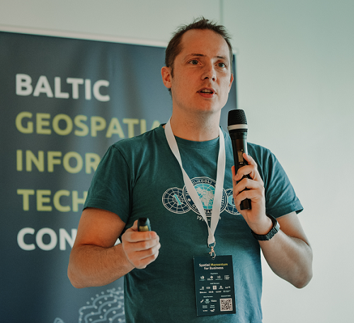
Alex Kmoch
Alex is a Distributed Spatial Systems Researcher with many years of international experience in geospatial data management and web- and cloud-based geoprocessing with a particular focus on land use, soils, hydrology, and water quality. His interests include OGC standards and web-services for location-based data sharing, modelling workflows, machine learning, and interactive geo-visualisation. Alex has been involved with SDIs and the OGC for a long time and was recently elected board member of the Estonian Geoinformatics Society (EstGIS) and European Co-Chair for the OGC University Domain Working Group. He is based at the Chair of Geoinformatics and Cartography at Department of Geography of the University of Tartu.
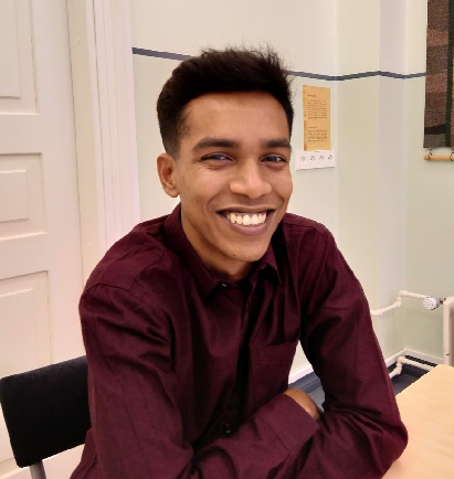
Tahmin Sitab
Tahmin Sitab is a masters student at the Geoinformatics for Urbanised society programme at University of Tartu. He did his bachelors in anthropology from Bangladesh. He is interested in the intersection of sociology and geography and almost every other topic. He firmly believes that you can love both a cat and a dog.